Teal Lake fishing
Teal Lake fishing is on a natural lake. The stocking report does not name the species. It is stocked 2 times in 2026, most often in June and August.
- Last stocked
- August 28, 2026
- Plants on record
- 2
- Species recorded
- 0
- Elevation
- 8,812 ft
Fish at Teal Lake
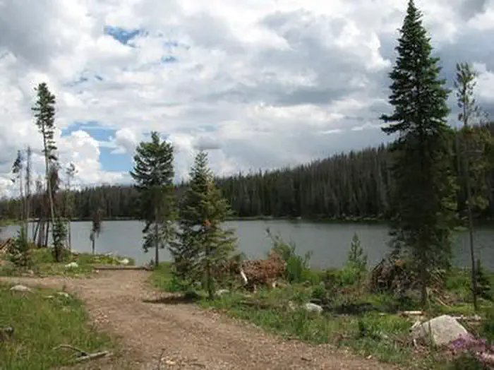
Teal Lake, which is a 50-acre lake, offers opportunities for trout fishing. The lake is surrounded by a rocky shoreline and a pine-fir forest. (fs.usda.gov, accessed September 22, 2026)
Drafted by AI from the cited sources and checked before publishing.
How Teal Lake is stocked
Access and facts
- Water type
- natural lake
- Nearest town
- Walden
- Shore access
- Yes
- Facilities
- restrooms, camping
Small glacial lake (about 50 acres) in Routt NF. From Walden: Hwy 14 west 11 miles to Hebron, County Road 24 (becomes FR 60) about 10 miles, then FR 615 about 3 miles; map apps often misroute. Rocky shore, lakeside picnic site with fishing access, primitive small-boat launch, campground.
Drafted by AI from the cited sources and checked before publishing.
Advisories, closures, regulations and water conditions change. Check the Colorado Parks and Wildlife before you go.
About Teal Lake
Black bears, bobcats, coyotes, elk, mule deer, and moose are among the many animals inhabiting the Medicine Bow-Routt National Forests where Teal Lake is located. (fs.usda.gov, accessed September 22, 2026)
Drafted by AI from the cited sources and checked before publishing.
Nearest lakes
Public land at Teal Lake
Teal Lake is 0.2 miles outside the edge of Mount Zirkel Wilderness.
Boundaries from Public Lands DB, part of the same network.
Common questions
When is Teal Lake stocked?
Last stocked August 28, 2026. It is stocked 2 times in 2026, most often in June and August.
How do you get on Teal Lake?
Shore fishing is available. The nearest town is Walden. Facilities include restrooms and camping. Small glacial lake (about 50 acres) in Routt NF. From Walden: Hwy 14 west 11 miles to Hebron, County Road 24 (becomes FR 60) about 10 miles, then FR 615 about 3 miles; map apps often misroute. Rocky shore, lakeside picnic site with fishing access, primitive small-boat launch, campground.